Understanding the Importance of
Weather Satellites
Our everyday view of the atmosphere is from the bottom looking up and around. Our field of view is limited since most of us can see only a few kilometers in any direction. At the same time, the systems that dominate our weather can be hundreds or even thousands of kilometers across. Weather maps and radar have extended our views, but it is the weather satellite that gives us a completely different perspective on the weather. Orbiting satellites are platforms from which the atmosphere and surfaces below can be observed from the outside.
By looking down on the weather, we can see that fair and stormy weather are somehow related. Clear areas and giant swirls of clouds fit together. In the continually changing atmosphere, we can observe evidence of predictability through the order and evolution of weather systems. With the launch of TIROS-1 in 1960, we gained our first total views of the cloud patterns that accompany low-pressure systems and fronts. Areas of high pressure and fair weather also became apparent by their general lack of clouds. The launch of TIROS culminated in a long march of technological advances in electronics and space exploration. The use of electronics for the sensors, information storage, and transmissions to Earth depended upon the newest transistor technology. The sensors themselves depended upon television research for their images. Later sensors were outgrowths of this and went on to solid-state extensions where heat radiation, as well as light, from Earth, could be measured.
Finally, the signals that are measured electrically are converted to digital values for storage and are later transmitted down to Earth. There, the visual images we are familiar with, are produced. This last step is highly dependent on computer technology for the assembly, organization, and interpretation of the data. We now have two basic types of satellite systems. The descendants of TIROS are known as polar-orbiting satellites. They revolve around the Earth at relatively low altitudes, 800 kilometers (500 miles) or so, passing over the polar regions as Earth rotates underneath. Such an orbit takes about 100 minutes to complete. Most places are scanned twice a day, once in daylight and once in darkness. Large-scale views are made from composites of several orbital strips that are about 1900 kilometers (1200 miles) in width.
Here is a list of weather satellites with a brief description of their purpose:
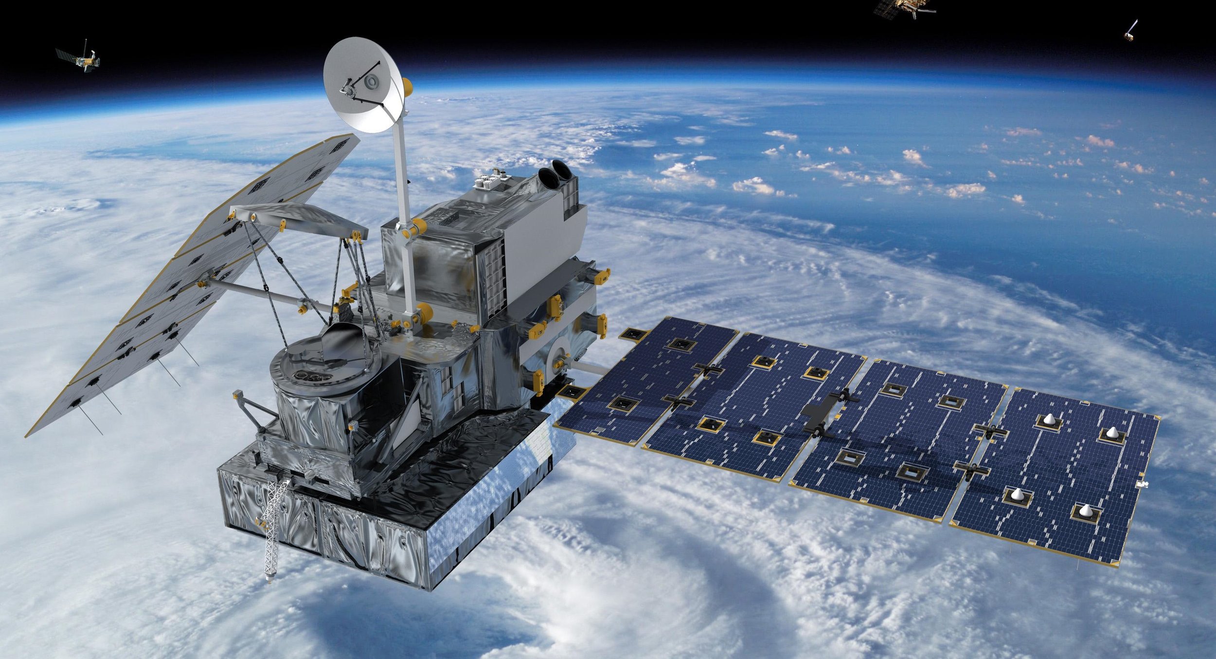
Tropical Rainfall Measuring Mission (TRMM)
ITRMM examines at cloud structure and precipitation mostly at the equator. Because of TRMM, scientists can better predict global energy balances, water cycles and El Niño.
Image Credit: NASA

Geostationary Operational Environmental Satellite (GOES)
GOES knows weather. Since 1975, this geostationary squad of satellites are unsung heroes in forecasting our planet’s weather.

Image Credit: NASA;
National Oceanic and Atmospheric Administration Satellite (NOAA)
NOAA satellites enable us to get a complete view of weather and environmental conditions around the world each day.

Image Credit: NASA
METEOSAT
Meteosat is the geostationary observer in Europe and Africa. By beaming images of Europe’s weather every 15 minutes, it’s ideal for weather forecasting.
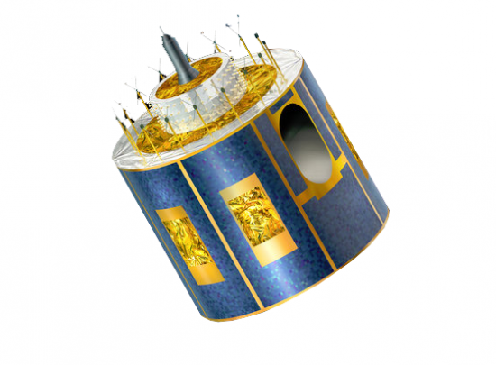
Image Credit: ESA
Aqua
Aqua is NASA’s multi-purpose satellite. Not only does it tap into Earth’s water cycle by measuring relative humidity (AIRS/AMSU), but it estimates cloud height (CERES) and energy flux (AMSR-E).

Image Credit: NASA
Cloud-Aerosol Lidar and Infrared Pathfinder Satellite Observations (CALIPSO)
Using laser technology and a special sensor for cirrus cloud, CALIPSO graphs the vertical profiles of cloud structure.

Image Credit: NASA
Television Infrared Observation Satellites (TIROS)
In the 1960s, TIROS was instrumental in sending early storm warnings. Specifically, this low-Earth orbiting satellite was built for televising infrared weather observations.

Image Credit: NASA
CloudSAT
With its head in the clouds, this satellite profiles their vertical billowing formation with radar. It’s key for understanding the atmospheric and hydrological cycles because the influence clouds have on weather and climate.

Image Credit: NASA
Aura
Aura is NASA’s satellite dedicated to uncovering air quality and climate health. For example, its 4 instruments (HIRDLS, MLS, OMI & TES) measure trace gases, temperature, and aerosols in the upper atmosphere.

Image Credit: NASA
Suomi
Suomi orbits the poles for the purpose of weather forecasting, land and ocean studies. Throughout history, it’s captured views of monstrous tornadoes and supercells.

Image Credit: Copyright © NOAA
Polar-orbiting Operational Environmental Satellites (POES)
NOAA’s polar-orbiting meteorological satellite (POES) has taken some of the mystery out of atmospheric phenomena with high spatial and temporal resolution images.

Image Credit: NOAA
Soil Moisture Active Passive (SMAP)
SMAP is equipped with a pair of active and passive sensors to measure fine-scale global soil moisture. Due to a sensor malfunction, it’s all passive similar to SMOS.

Image Credit: NASA
SciSAT
SciSAT creeps through the shadows of Earth. Only on the dark side of Earth, it can record the depletion of ozone. That’s why it’s nicknamed the nightcrawler satellite.

Image Credit: Canadian Space Agency
ACRIMSAT
The solar-monitoring ACRIMSAT performed experimental studies for solar irradiance. In fact, it recorded a 0.1% reduction in solar intensity caused by the Venus shadow in 2004.

Image Credit: NASA/JPL
Megha-Tropique
Megha-Trophique will cruise the tropics to better understand the global water cycle. As part of the Global Energy and Water Cycle Experiment (GEWEX), it aims to study climate change.

Image Credit: ESA